Tackling Australia’s weeds with WeedScan

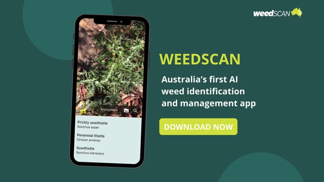
Launched in December, WeedScan is a new, easy-to-use, digital tool that Australian woolgrowers – plus other landholders, community groups and NRM bodies – can use to identify, report and map priority weeds in their local area.
Weedscan Benefits
- Helps you identify priority weeds quickly without expert knowledge.
- Provides you with easy access to best practice management information.
- Enables you to find out what priority weeds have been recorded in a specific location.
- Suitable for weed management either at the individual enterprise level or as part of a community-led regional WeedScan network.
- WeedScan offers the greatest benefits when it is used regularly, by lots of people, and when linked with relevant local groups.
Weeds can be a major threat to pasture productivity, native vegetation and biodiversity. However, Australia’s first artificial intelligence (AI) app for weed identification, notification and management is now available to help make the fight against weeds more efficient.
WeedScan is a free and easy-to-use tool that allows users to identify, report and map more than 450 priority weeds and other weeds present in Australia.
The digital tool is powered by a CSIRO AI identification model and has been trained on more than 120,000 weed images. It has been tested across Australia by scientists, farmers, community groups, agronomists, rangers, and weeds and natural resource management officers.
A key feature of WeedScan is that the weeds identifiable by the app include many new and emerging priority weeds that may not be known to most people.
If you want to know where a particular priority weed species has been recorded, or what priority weeds have been recorded in a specific location, you can explore the WeedScan records. This will become more populated with records as more and more people use WeedScan.
WeedScan is simple to use
After having downloaded the app, simply:
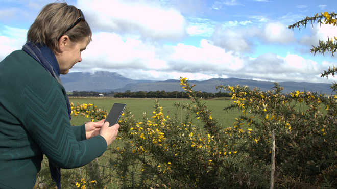
- Snap a photo of a plant you suspect is a weed; and
- Upload it to WeedScan.
WeedScan’s AI model will then assess your photo against verified images of weeds. Within seconds, WeedScan will suggest possible plant identifications, with degrees of confidence for each suggestion.
WeedScan can be downloaded to your smartphone or tablet from the App Store (iOS) or Google Play (Android) – simply type in WeedScan to search for the app. The tool can also be accessed via the website at www.weedscan.org.au, along with supporting resources including user guides and an introductory ‘how-to’ video.
Note: WeedScan will only function as desired on devices with Android 11 and above, and on iOS devices which are still supported by Apple (currently 16 and above).
A community tool for better weed control
While WeedScan allows you to identify and record a suspect weed on your own property for your own use and action, it is most effective when used as a collaboration tool with other local farmers and stakeholders to monitor and stay informed about weeds in the area, thereby assisting everyone to apply best practice control.
For example, if you are part of a local Landcare or other group, you can create your own in-app group to share your records and observations for improved weed control. Plus, using the embedded weed biology and management information relevant to your location, you can alert state and local land managers of new incursions.
Managed by the Centre for Invasive Species Solutions
WeedScan is managed by the Centre for Invasive Species Solutions (CISS), which also manages the pest animal mapping program FeralScan. CISS CEO Andreas Glanznig says WeedScan has the potential to revolutionise weed management in Australia.
“Weeds management is notoriously difficult because weeds can be challenging to identify. Correct identification is the key to effective weed management. Knowing what weeds are present in our environment and where they are located informs strategies to reduce the economic, environmental and social impacts of weeds,” Mr Glanznig said.
“WeedScan will provide graziers, farmers, bush regenerators, communities, natural resource management bodies and governments with a free, easy-to-use digital tool that enables priority weeds to be identified quickly while providing access to best practice management information.”
WeedScan is also supported by CSIRO, NSW Department of Primary Industries (DPI) and South Australian, Queensland and Victorian Governments, and Atlas of Living Australia. The program was funded by the Australian Government’s National Landcare Program.
More information: www.weedscan.org.au
This article appeared in the March 2024 edition of AWI’s Beyond the Bale magazine. Reproduction of the article is encouraged.


