Pest animal monitoring using FeralScan
FeralScan™ is a free, purpose-built, digital resource that Australian woolgrowers – plus other landholders, community groups and professional pest animal controllers – can use to record and access information about pest animal populations and their management in their local area.
Fast facts
- FeralScanTM is a community-designed, national, online platform that enables people to record and monitor pest animals (such as wild dogs, foxes, rabbits and feral pigs) in their local area.
- The platform provides a local area map of pest activity which can help woolgrowers and others collaborate to implement effective pest animal control.
- Free to use, FeralScan™ consists of an easy-to-use mobile phone app (which can be used without phone reception) and an interactive website map.
- The use of FeralScanTM is growing, with more than 46,000 individuals and 690 local groups across Australia registered to use the platform.
- FeralScanTM securely hosts pest monitoring and control data for thousands of farmers, land managers, pest controllers and biosecurity groups across Australia.
- It can rapidly send alert notifications to group members to quickly inform them of pest animal threats, such as a nearby wild dog sighting or attack.
- FeralScanTM offers the greatest benefits when it is used regularly, by lots of people, and when linked with relevant local groups.
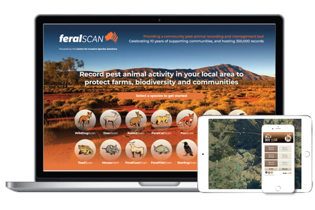
The FeralScan™ platform comprises 14 species-based websites and a user-friendly phone app (in Apple and Android formats) that can be downloaded in the Apple or GooglePlay stores.
With more than 46,000 registered users across Australia, FeralScan™ is the nation’s largest and most popular community platform for monitoring and recording pest animal activity and management.
Farmers, landholder groups, professional pest controllers and others use FeralScan™ to map sightings and evidence of pest animals, document attacks on livestock and other damage, and keep a secure record of on-farm pest control activities.
FeralScan™ is available as an interactive website and mobile phone app, both of which have been designed to be simple to use. Alert notifications (by email or through the app) can be sent to user groups to inform them quickly about local pest animal threats.
FeralScan™ is free to use and receives funding from AWI, the Department of Agriculture, Fisheries and Forestry and NSW Department of Primary Industries (DPI) through the Centre for Invasive Species Solutions (CISS).
AWI Program Manager Vertebrate Pests, Ian Evans, says FeralScan™ is a collaboration tool that can help woolgrowers and other local stakeholders monitor and stay informed about pest animals in their area, thereby assisting them to apply best practice control.
“Used effectively, FeralScanTM can provide woolgrowers and other community decision makers with accurate and timely information about the distribution and problems associated with pest animals. This information is very valuable for guiding local management decisions on how and when to control pest animals,” Ian said.
“The more people in a local area that use FeralScanTM, the more useful it becomes.”
“When we record wild dog activity in FeralScanTM, the map shows where the problem areas are, and what time the wild dogs are coming through. FeralScanTM also notifies our landholders, and this helps people to be more aware of wild dog activity and helps them decide when to undertake control.”
- Helen Lawson, Secretary of the Hargraves-Hill End Pest Control Group
Recording pest animal activity using FeralScan™
FeralScan™ is a free resource that has been designed by landholders and is very easy to use. There 14 sections covering invasive pest species in Australia, including sections for the key pest animals that affect woolgrowers: WildDogScan, FoxScan, RabbitScan, FeralPigScan and DeerScan.
What to record
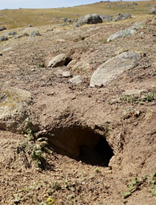
- Sightings and evidence of pest animals (eg wild dog footprints, rabbit warrens)
- Damage caused by pests, such as attacks (ie livestock predation) or soil erosion around rabbit warrens)
- Control activities (eg baiting or trapping for wild dogs and foxes, rabbit warren ripping)
- Photos of any of the above from a smartphone or a monitoring camera.
The FeralScanTM app uses the inbuilt GPS receiver in a smartphone to calculate the user’s current location, enabling the user to obtain precise location data to accompany their observation; users can choose an alternative location using an interactive map. Information can be recorded using the app even in areas that have no mobile phone coverage.
Trusted app with proven benefits to the community
FeralScan™ national coordinator and invasive species specialist with NSW DPI, Peter West, says FeralScan™, which was launched nearly 13 years ago, is a robust and secure platform, now widely used to assist woolgrowers and others with pest animal monitoring and control.
“Continuous input from farmers and other users has delivered an important resource which informs pest animal management programs across the country. It is being used by farmers, land managers, communities, landholder groups, local government, pest control professionals and biosecurity groups, amongst others,” Peter said.
“The number of users of FeralScan™ has increased markedly during the past two years, from 23,400 people in 2020/21 to 47,000 people by September 2023. This demonstrates a high demand for FeralScan™, which has become an increasingly essential resource for communities and pest managers.”
The FeralScan™ database currently contains more than 415,000 reports and photos of pest animals across Australia, with the largest datasets being for the key pest animals that affect the businesses of woolgrowers: wild dogs, rabbits, foxes, feral pigs and feral deer.
Managing data securely and privately
FeralScanTM manages data from people securely and responsibly. It gives people a choice to share data with others, or to keep data private, and all sensitive information is kept secure.
“This gives people confidence in recording pests and pest control in their local area knowing that sensitive data is not disclosed to others,” Peter said.
“Where FeralScan™ can also provide great benefit is when private groups are set up that include all land managers across a district.
“This ensures that people are able to record pest animal activity, and share information with their private group or community, to help guide pest management at the landscape scale.
“More than 690 private landholder, community and biosecurity groups across Australia have currently registered to use FeralScan™ for their local pest monitoring and management activities. The number of groups is steadily increasing.”
How alert notifications happen:
- Someone sees a pest, or evidence of a pest (eg an attack on livestock) in the paddock.
- That person records that information into the FeralScanTM app while in the paddock.
- That information is submitted and enters a secure database.
- An alert notification is sent to the person’s landholder group, professional pest controller, and a biosecurity officer.
- Those people receive the alert, and can then act appropriately on it.
Support aids adoption
Peter has travelled across Australia since the platform’s launch to consult with and support landholder and community groups to ensure they are getting the full benefits of the resource.
“We have helped communities use FeralScanTM across all states and territories, and will continue to assist anyone wanting to use this free resource,” Peter said.
To increase the uptake and use of FeralScanTM, there have been more than 350 workshops, online webinars, information sessions, field days and training events to major stakeholder groups across Australia, during the past five years alone. A series of short videos, including ‘farmer-teaching-farmer’ style videos has also been made available on the CISS YouTube channel to provide instruction and guidance to users and stakeholders.
More information: www.feralscan.org.au
Use of WildDogScan in the Hunter region of NSW
Professional wild dog controllers operate throughout the Upper Hunter region of NSW in partnership with the Hunter Local Land Services (LLS) and NSW National Parks and Wildlife Service. They operate across private and public lands, using the WildDogScan component of the app to document their control activities.
Information they record is managed securely and is shared with the relevant local wild dog control associations operating in the area. Information recorded by landholders within those associations is also instantly shared with the professional wild dog controllers to alert them to recent wild dog activity, or attacks on sheep. As a communication tool, WildDogScan is becoming increasingly helpful.
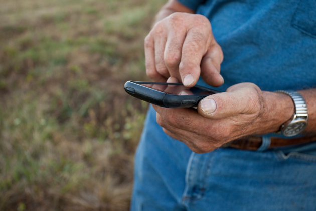
AWI-funded North East NSW wild dog coordinator Dave Worsley demonstrating the use of the FeralScan™ app to record evidence of wild dogs on a farm.
This article appeared in the December 2023 edition of AWI’s Beyond the Bale magazine. Reproduction of the article is encouraged.


